Augmented Reality
AR stands for Augmented Reality. In simple terms, AR on your smartphone will superimpose information or graphics over what its camera “sees.” What this feature does is to show you navigation indications straight over the reality around you. This can help make walking to your destination easier. Currently, it’s only available for walking navigation, though. There are just a couple of conditions that go with using AR on Google Maps. Your phone supports ARCore if it’s Android or ARKit on iPhone. And it not going to work in dark environments. But in my experience, it works well at night on streets that have good public illumination. Also, keep in mind the Street View images for the respective area need to be recent for the best experience. And the feature doesn’t work inside buildings. Still, it’s pretty cool and here we’ll take a look at what you can expect. Note that the screenshots in this article are from the Android app. But the experience on an iPhone is similar.
AR in Reality
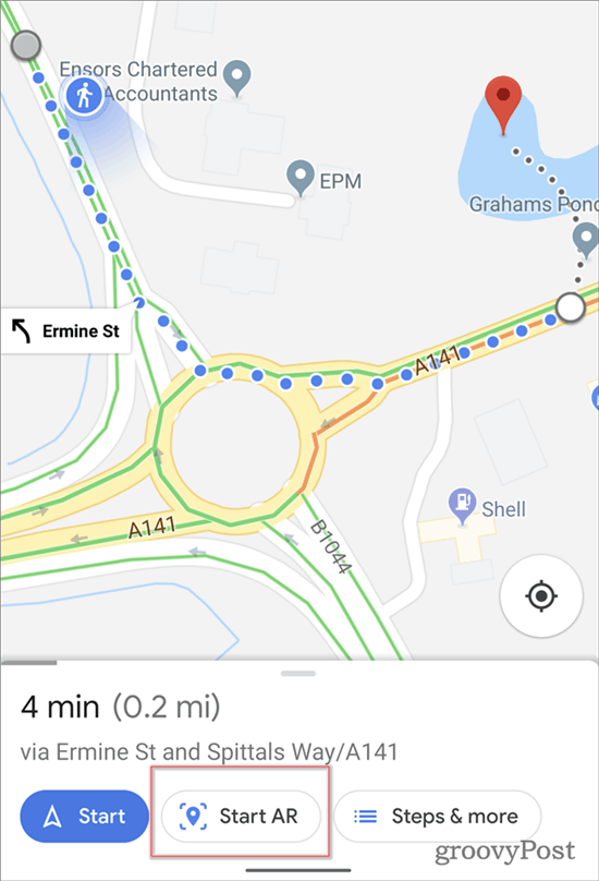
Using the feature couldn’t be easier. You just tap your destination in Google Maps as you normally would. If AR Navigation is available, you will get an additional button at the bottom of the screen.
Just tap the button. The application might prompt you to turn around, so it can figure out its location. Note that it might take a moment to process the location.
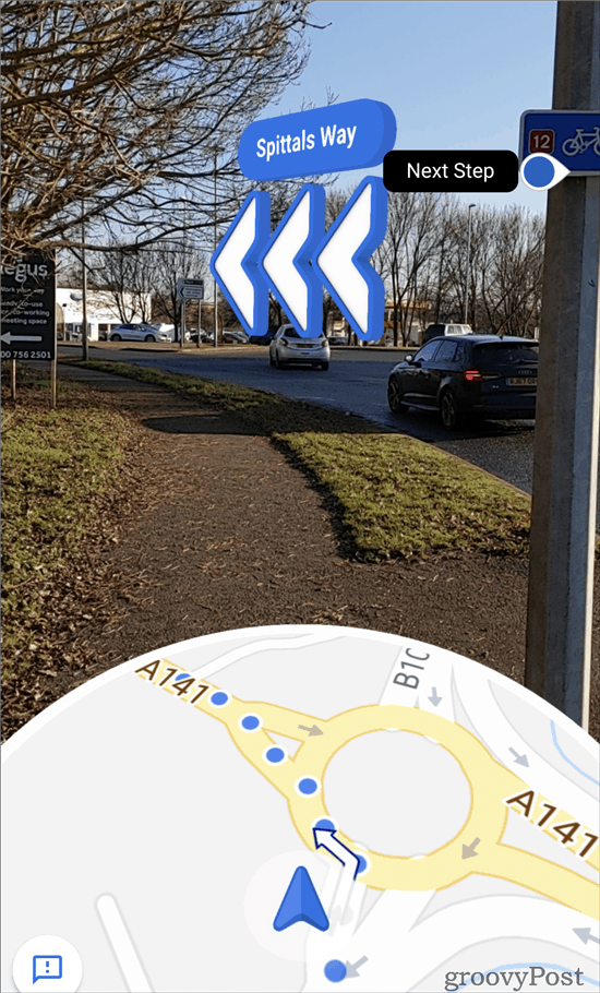
Once that’s done, the cool part starts. AR Navigation comes to life and you’ll see indications in forms similar to the one shown below. I used it to walk through a busy Paris location and it was a breeze.
While it is a very useful feature, it is only available for walking navigation. Hopefully, we’ll see this for car navigation in the future. Perhaps shown on an Android Auto or Apple CarPlay screen. Have fun and try it out and see how well it works for you while walking through unfamiliar communities!
![]()


